
UOG assists NASA team in mapping Guam’s coral reefs
UOG assists NASA team in mapping Guam’s coral reefs
UOG assists NASA team in mapping Guam’s coral reefs
5/16/2019

The University of Guam, as a partner of the Pacific Islands Climate Adaptation Science Center consortium, will be assisting NASA research scientists from May 8 to May 16 with a project to map Guam’s priority coral reefs using a state-of-the-art sensing technology.
The research scientists are from the NASA Ames Laboratory for Advanced Sensing (LAS) and will be using MiDAR and “fluid lensing” to study two shallow marine habitats — the Tumon Bay Marine Preserve and the Piti Bay Marine Preserve. These data will be used to create 3-D maps with an extremely high level of accuracy.
“We’re going to come away with three maps of coral here, hopefully to centimeter scale, that will help us understand where coral is, how healthy it is, and how it’s changing over time,” said Ved Chirayath, director of the LAS in the Earth Science Division at NASA Ames Silicon Valley.
Chirayath will be accompanied by NASA research engineers Alan Li and Jonas Jonsson, graphic engineer Jarrett van den Bergh, and safety officer Steve Patterson.
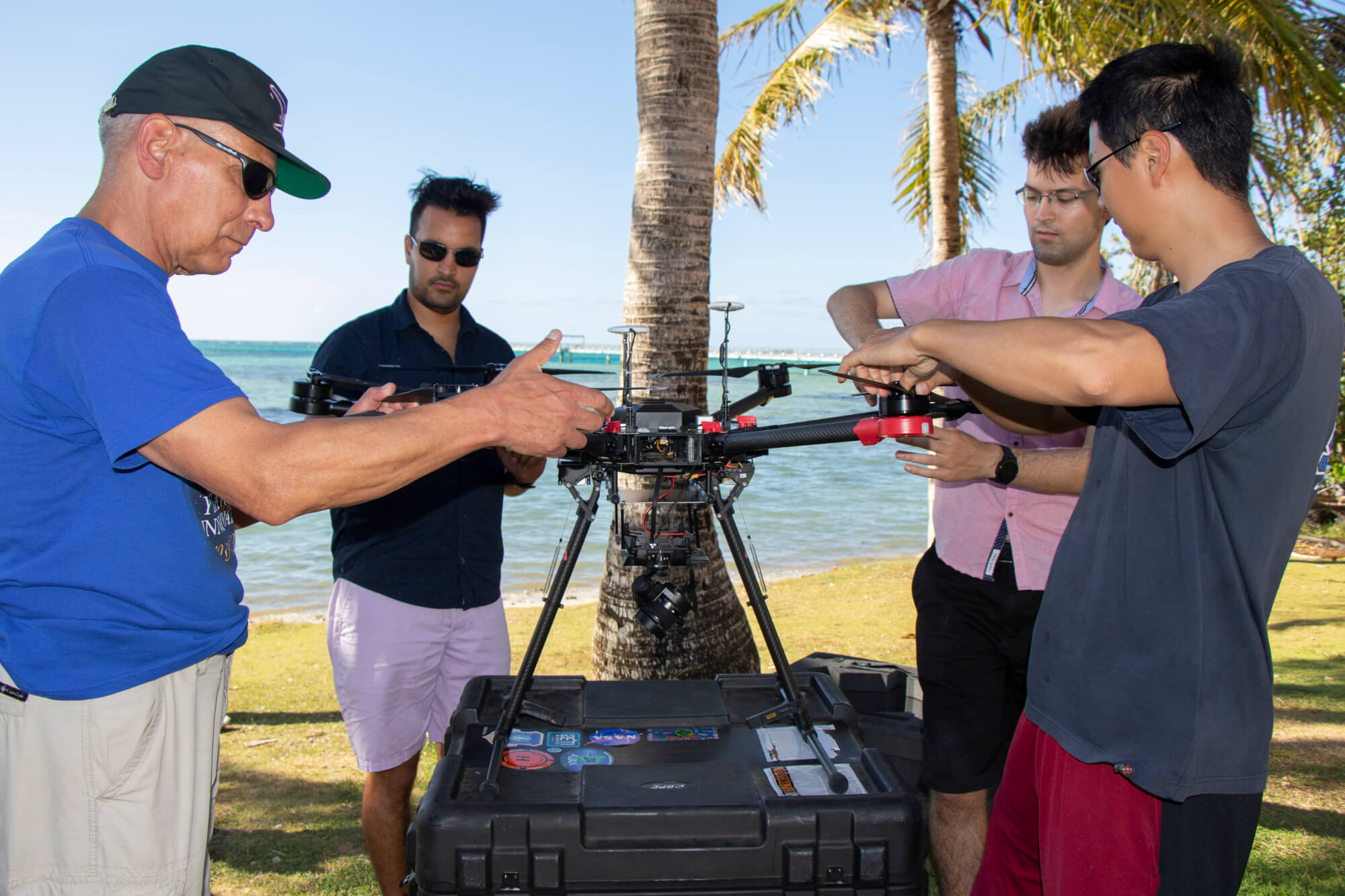
MiDAR is next-generation active remote sensing technology, patented by Chirayath, to collect multi-spectral datasets of these areas.
Sensors will be flown over the waters early in the morning and late at night, emitting quick flashes of light to capture imagery of the coral reefs. National Weather Service meteorologist Chip Guard will be providing weather and ocean briefings to the team.
Data from the coral mapping will also be used in NASA’s NeMo-Net, an online game in which users assist NASA in classifying coral reefs and other aquatic ecosystems. Some of Guam’s coral are featured in the game. More information on the game can be found at www.nemonet.info.
The project is funded in part by NASA and a grant from the U.S. Department of the Interior Office of Insular Affairs, which was obtained by the Guam Bureau of Statistics and Plans in alignment with the Guam Coral Reef Initiative. The Guam Department of Land Management’s land surveying division is also a partner in the project.
For more information on the project, please contact Dr. Romina King, UOG program director of the Pacific Islands Climate Adaptation Science Center, at roking@triton.uog.edu.
In the News
NASA producing 3D images of Guam's reefs - KUAM News
Visiting scientists use NASA technology to map Guam's reef system - Pacific News Center
NASA to launch drones, map Guam's marine preserves - Guam Daily Post