
- Home
-
Admissions
-
Academics
-
Students
-
Research
-
Research Centers
- Cancer Research Center
- Center for Excellence in Development Disabilities Education, Research & Service (CEDDERS)
- Center for Island Sustainability (CIS)
- Marine Laboratory
- Micronesian Area Research Center (MARC)
- UOG Land Grant | agInnovation Research Center
- Water and Environmental Research Institute (WERI)
-
Programs and Departments
- Guam EPSCOR
- Guma' Tinemtom - Micronesia Data Laboratory
- Pacific Islands Climate Adaptation Science Center (PI-CASC)
- Pacific Islands Cohort on Cardiometabolic Health (PICCAH)
- Research Corporation of UOG
- RFK Memorial Library
- UOG Press
- UOG Sea Grant
- University Libraries Digital Team
- NASA Guam Space Grant
- NASA Guam EPSCoR
-
Research Centers
-
Outreach
- Giving
- Alumni
-
About
UOG Drone Corps conducting surveys of vital forest conservation area
UOG Drone Corps conducting surveys of vital forest conservation area
UOG Drone Corps conducting surveys of vital forest conservation area
10/3/2025
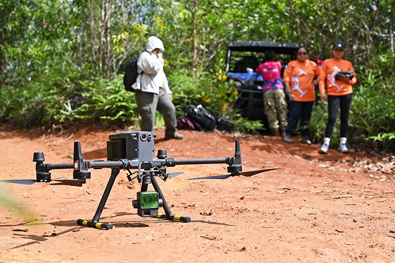
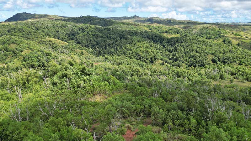
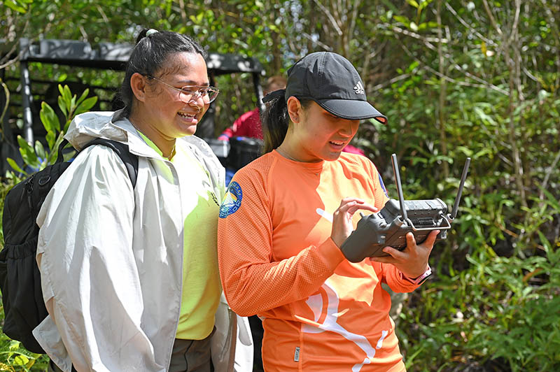
The UOG Drone Corps has been a longtime supporter of the Guam Department of Agriculture’s Forestry & Soil Resources Division’s efforts in conservation and monitoring. One ongoing project includes regular surveying of one of its largest reserves: the Cotal Conservation Area, located between Yona and Sånta Rita-Sumai in southern Guam.
Through a U.S. Department of Agriculture McIntire-Stennis grant — which provide funding to support research in the production, utilization, and protection of forestland and to train future forestry scientists — the UOG Drone Corps is working with the Guam forestry team to develop a robust remote pilot forest monitoring program. Drone pilots are currently conducting biannual surveys of the conservation area to produce high-resolution maps that document reforestation progress. Lidar data is also being collected by the drone, providing topographical information of the area. This information will help Forestry determine sites where replanting may be more successful, and other sites that may need soil amendments to improve reforestation.
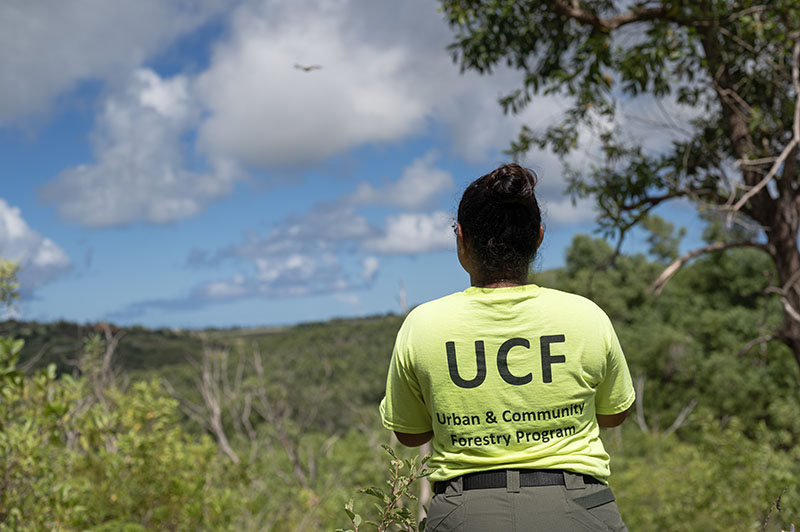
An additional component of the project involves monitoring soil health. The Forestry team has planted acacias in the conservation area, as acacias are known to enrich soil with plant-friendly nitrogen and keep soil intact to prevent erosion. Over time, native trees will be planted alongside the acacias, essentially revitalizing a native forest. The Soil Laboratory under the UOG agInnovation Research Center is tasked with conducting soil tests at various points at the site. From there, Forestry can assess which parts of the land are ready for native planting.
This collaboration is a testament to how emerging technologies in science can aid local natural resource management. With drone imagery, the Forestry team can increase efficiency in their surveying efforts without straining its workforce.
About UOG Drone Corps
The UOG Drone Corps aims to build technical capacity for drone services on Guam by creating a cadre of Federal Aviation Administration Part 107b-licensed, informed, and responsible remote pilots. It is a program under the agInnnovation Research Center of the University of Guam Land Grant system, which provides instruction, research, and community outreach specific to agriculture, food, natural resources, nutrition, and consumer science in order to improve life in Guam and Micronesia.
Photos by the UOG MAGIC Lab