

PI-CASC
UOG & PICSC
PI-CASC
University of Guam Climate Science Research
The Pacific Islands Climate Adaptation Science Center is a consortium led by the University of Hawaiʻi at Mānoa, the University of Hawaiʻi at Hilo and the University of Guam to provide expertise in developing and applying climate change science to societal and ecological challenges across the Pacific Region.
The University of Guam Pacific Islands CSC conducts climate science outreach and research
to foster awareness of Guam's changing environments & to find solutions specific to
ecological challenges in the Micronesian Region.
The University of Guam's CSC Climate Science Research Projects
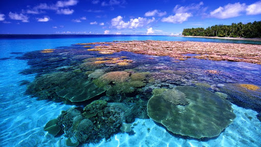
Assessing the Sustainability of Culturally Important Marine Sites in Guam and CNMI

Lead Contact(s): Laurie Raymundo, Jeffrey Maynard, John Peterson, Peter Houk, Ruben van Hooidonk,
Steven McKagan, Lyza Johnston, Robert Greene
CSC/NCCWSC: Pacific Islands CSC
Keywords: CSC, Pacific Islands CSC, 2015, coral reefs, projections, outlook reports
Fiscal Year: 2015
Start/End date: 2015-2017
Status: In Progress
Organization(s): University of Guam, Marine Applied Research Center, University of Miami, NOAA Fisheries
in Saipan, CNMI Bureau of Environmental & Coastal Quality
Type: Project
SUMMARY
This project will use climate models to produce projections of changes in sea temperatures and ocean chemistry for coastal marine areas in Micronesia as well as reports that describe the outlook of culturally important marine sites in Guam and CNMI. The projections and maps will show what the current state of climate science suggests the future holds for marine areas in Micronesia if we continue to use fossil fuels aggressively. These projections of sea conditions will become the foundation of outlook reports for Tumon Bay in Guam, Lao Lao Bay and Saipan Lagoon in Saipan, and northern Tinian Island. The selected areas are among the most important sites for recreation in Guam and CNMI and, as such, are key to the economy of these islands. The outlook reports will describe pressures in the focus areas as well as current ecosystem state and will forecast the sustainability of the sites under current and alternate management regimes. Project outputs are being collaboratively developed with resource managers to ensure the outlook reports identify and prioritize near and long-term actions to maximize sustainability and goods and services provision. Community members, stakeholders and managers will be interested in the outlook reports as many of the high priority actions identified will require reducing pressure on coral reefs through changes in human activities on the land and in the water.
Collecting Elevation Data to Understand Climate Change Effects in the Marshall Islands
Lead Contact(s): Jeffrey J. Danielson, Monica Palaseanu-Lovejoy, Cindy Thatcher, Dean B. Gesch, Matthew
Barbee, Romina King, Maria Kottermair, Andrea Jaladoni
CSC/NCCWSC: Pacific Islands CSC
Keywords: CSC, Pacific Islands CSC, 2016, Topography, Bathymetry, Elevation, Sea-Level Rise,
Coastal, Insular, Pacific Islands
Fiscal Year: 2016
Start/End date: 2016-2016
Status: In Progress
Organization(s): USGS Earth Resources Observation and Science (EROS) Center, USGS Eastern Geographic
Science Center, Cooperative Data Acquisition, NGPO, Geographic Science Team, EROS,
University of Hawaiʻi, University of Guam
Type: Project
SUMMARY
The Intergovernmental Panel on Climate Change reports that low-lying atolls (ring-shaped islands or island chains made of coral) in the Pacific Ocean are extremely vulnerable to high tide events (“king tides”), storm surge, tsunamis, and sea-level rise. The Republic of the Marshall Islands (RMI) spreads over 29 atolls and has a population of over 50,000 people with homes and communities that may be threatened by these climate change-related events. Policy makers, planners, and others within RMI are faced with decisions about how to prepare for the future and need scientific data and information about the vulnerability of Pacific Islands to potential climate change impacts like sea-level rise. Topographic and bathymetric data are needed to map out the overland and underwater formations that comprise RMI. These maps can then be used to calculate and visualize potential effects and damage from wave inundation and other coastal hazards. To help address this need, the Pacific Islands Climate Adaptation Science Center is collaborating with the USGS Coastal National Elevation Database (CoNED) program to collect topographic and bathymetric data and develop a Digital Elevation Model (a 3D representation of the terrain) for the southern half of Majuro Atoll (home to the capital city and largest population of RMI) that can be used to visualize and project climate change impacts. Data collection and field work will occur in September 2016.
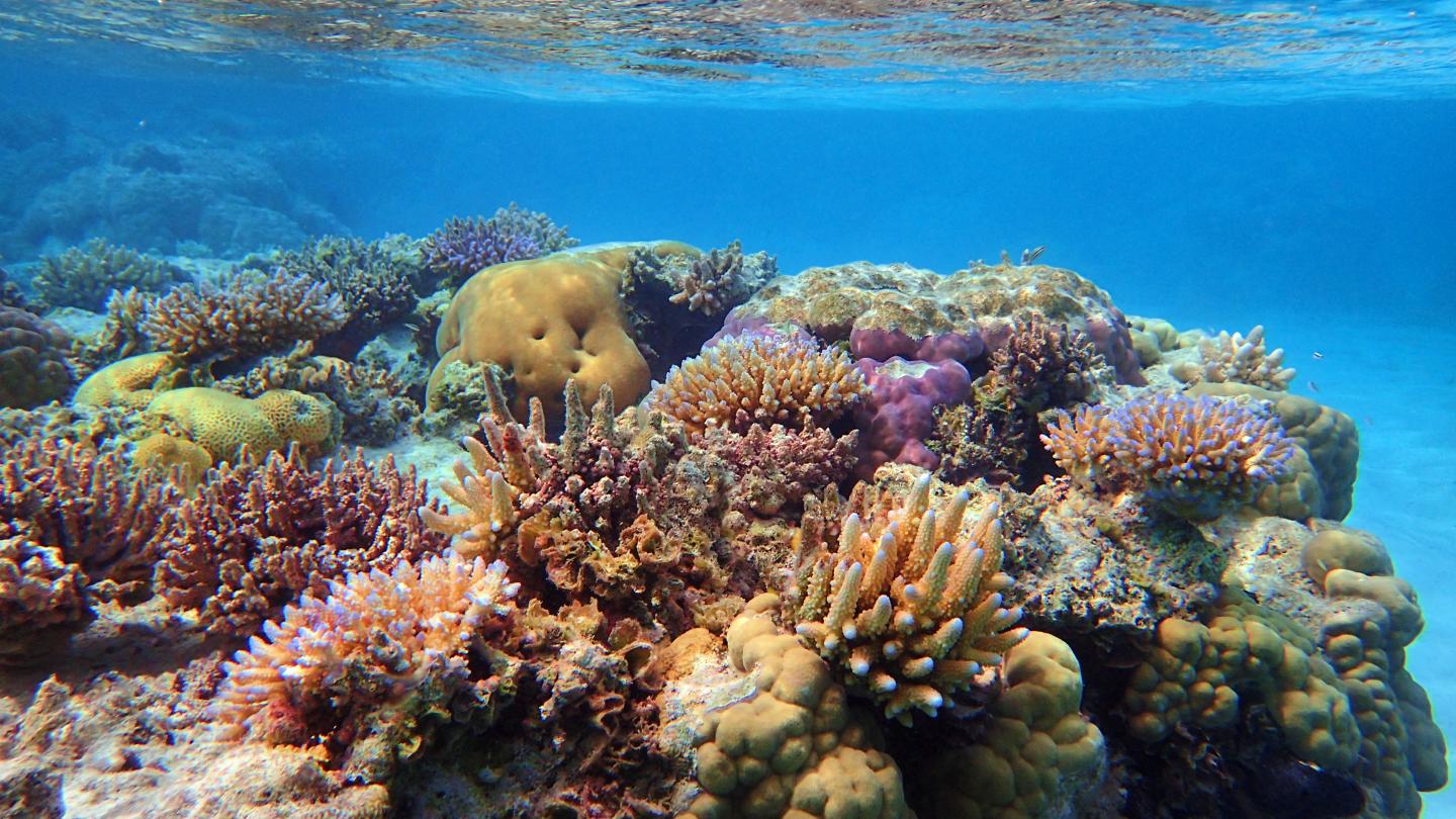
Final Report: Coral Reef Resilience to Climate Change in CNMI
Lead Contact(s): Jeffrey Maynard, Laurie Raymundo
CSC/NCCWSC: Pacific Islands CSC
Keywords: Coral Reef, Climate Change, Mariana Islands, Vulnerability, Resilience
Start/End date: 2013-2016
Status: Completed
Organization(s): Marine Applied Research Center Wilmington, NC, Marine Laboratory, University of Guam
Type: Other
SUMMARY
Reducing coral reef vulnerability to climate change requires that managers understand and support the natural resilience of coral reefs. We define coral reef resilience as the capacity of a reef to resist and/or recover from disturbance given its probable exposure regime, and maintain provision of ecosystem goods and services. Spatial variation in exposure to disturbance and the resilience of reefs in the face of those disturbances will determine the fate of coral reefs within management jurisdictions. This project sought to: (1) undertake ecological resilience assessments in the Commonwealth of the Northern Mariana Islands (CNMI), which is in the west Pacific near Guam, and (2) collaboratively develop a decision-support framework with local manager partners for resilience-based management. Between 2012 and 2014, our team surveyed 78 sites along the 30-foot contour of the fringing reefs surrounding the most populated islands in CNMI: Saipan, Tinian/Aguijan, and Rota. These surveys, and complementary analyses using data from environmental monitoring satellites and computer models, included measurements and assessments of variables that are ‘indicators’ of the processes that underlie reef resilience (e.g., recruitment of new corals and the control of macroalgae on reefs by herbivory). The final results are scores for relative resilience potential that resulted in our ranking the survey sites within and among the islands from high to low resilience. We also assessed two proxies of anthropogenic stress: land-based sources of pollution (e.g., nutrients and sediments) and accessibility due to wave exposure (e.g., fishing access). We found resilience potential to vary greatly within and among islands and set seven custom criteria within a decision-support framework that identifies sites that warrant management attention. This project represents globally relevant progress in the novel approach of using resilience assessments to inform management decision-making. Uniquely, the project was highly collaborative, undertaken with local managers in CNMI who are using the results to inform resilience-based management and management planning.
Assessing Relative Resilience Potential of Coral Reefs to Inform Management
Lead Contact(s): Jeffrey Maynard, Steven McKagan, Laurie Raymundo, Steven Johnson, Gabby N. Ahmadia,
Lyza Johnston, Peter Houk, Gareth J. Williams, Matt Kendall, Scott F. Heron, Ruben
van Hooidonk, Elizabeth Mcleod, Dieter Tracey, Serge Planes
CSC/NCCWSC: Pacific Islands Center
Keywords: Connectivity, Coral reefs, Environmental Management, Spatial planning, Vulnerability
Fiscal Year: 2015
Publication date: 2015
Organization(s): Marine Applied Research Center, Wilmington, NC, NOAA Fisheries, University of Guam,
World Wildlife Fund, Commonwealth of the Northern Mariana Islands, University of Guam
Marine Laboratory, Bangor University, NOAA/NOS/NCCOS Biogeography Branch, NESDID Center
for Satellite Applications and Research, NOAA Atlantic Oceanographic and Meteorological
Laboratory, The Nature Conservancy, CORAIL
Type: Publication
SUMMARY
Ecological resilience assessments are an important part of resilience-based management (RBM) and can help prioritize and target management actions. Use of such assessments has been limited due to a lack of clear guidance on the assessment process. This study builds on the latest scientific advances in RBM to provide that guidance from a resilience assessment undertaken in the Commonwealth of the Northern Mariana Islands (CNMI). We assessed spatial variation in ecological resilience potential at 78 forereef sites near the populated islands of the CNMI: Saipan, Tinian/Aguijan, and Rota. The assessments are based on measuring indicators of resilience processes and are combined with information on anthropogenic stress and larval connectivity. We find great spatial variation in relative resilience potential with many high resilience sites near Saipan (5 of 7) and low resilience sites near Rota (7 of 9). Criteria were developed to identify priority sites for six types of management actions (e.g., conservation, land-based sources of pollution reduction, and fishery management and enforcement) and 51 of the 78 sites met at least one of the sets of criteria. The connectivity simulations developed indicate that Tinian and Aguijan are each roughly 10 × the larvae source that Rota is and twice as frequent a destination. These results may explain the lower relative resilience potential of Rota reefs and indicates that actions in Saipan and Tinian/Aguijan will be important to maintaining supply of larvae. The process we describe for undertaking resilience assessments can be tailored for use in coral reef areas globally and applied to other ecosystems.