- Home
-
Admissions
-
Academics
-
Students
-
Research
-
Research Centers
- Cancer Research Center
- Center for Excellence in Development Disabilities Education, Research & Service (CEDDERS)
- Center for Island Sustainability (CIS)
- Marine Laboratory
- Micronesian Area Research Center (MARC)
- UOG Land Grant | agInnovation Research Center
- Water and Environmental Research Institute (WERI)
-
Programs and Departments
- Guam EPSCOR
- Guma' Tinemtom - Micronesia Data Laboratory
- Pacific Islands Climate Adaptation Science Center (PI-CASC)
- Pacific Islands Cohort on Cardiometabolic Health (PICCAH)
- Research Corporation of UOG
- RFK Memorial Library
- UOG Press
- UOG Sea Grant
- University Libraries Digital Team
- NASA Guam Space Grant
- NASA Guam EPSCoR
-
Research Centers
-
Outreach
- Giving
- Alumni
-
About
UOG students learn about GIS technology for practical, Guam uses
UOG students learn about GIS technology for practical, Guam uses
UOG students learn about GIS technology for practical, Guam uses
11/15/2022
There are technologies and eyes in the sky that offer real-world, Guam-specific uses.
A thick canopy of trees can be penetrated to spot potential archeological finds. A farm can get help with sensing if pests have invaded its crop. A survey for future land development can be made more precise. Remnants of World War II-era dugouts can be mapped with new technology, and the evolution of our reefs can be more easily tracked as well.
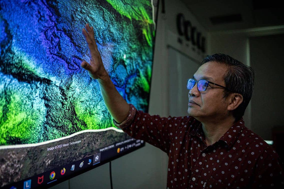
These real-world applications are possible through Geographic Information System or GIS, a computer system that is being taught at the University of Guam by an assistant professor who professes he has “fallen in love” with it for decades. This love comes next only to his wife, he quipped.
Jose Edgardo L. Aban, Assistant Professor of Remote Sensing/Geo-Spatial Technologies, has taught basic GIS at the University for almost four years now.
Before teaching at UOG, Aban used GIS to monitor vast palm oil tree farms in Indonesia.
This technology will be recognized worldwide during GIS Day Nov. 16, and UOG’s Geography Program in the College of Liberal Arts and Social Sciences will be a part of it – with an open house.
GIS is a scientific framework for gathering, analyzing, and visualizing geographic data to help people and entities make better decisions, according to GIS Day.
Many uses of GIS data
Students in Aban’s GIS classes can learn how to interpret and analyze data from satellite images which have many applications. For example, UOG students are finding the use of GIS for coral mapping here in Guam, Aban said.
Another more familiar use is a tool to help people and motorists get around unfamiliar places. As people use Google Maps, they can appreciate the technology, which is a spinoff of GIS, Aban said.
In Guam, data can be used for identifying structures, including potential archeological areas of interest, pest infestation in farms and even aid in land development and surveying, using coordinates, Aban said.
Devices that aid in remote sensing, such as lasers, satellite imaging and eyes through unmanned aerial vehicles or drones combined can help accomplish various tasks and projects – all related to GIS.
GIS can also be used along with LIDAR, an acronym for light detection and ranging. It’s a remote sensing method that uses pulsed laser to variable distances – to Earth.
With these technologies, not even a thick canopy of jungle can hide what’s beneath it and discoveries don’t need to be done by first visiting the actual site.
The uses for GIS and its related technologies are vast, Aban said.
And the possibilities for UOG students to discover are limited only by their time and thirst for learning.
Learn more about GIS:
Contact Assistant professor Edgardo L. Aban, at the College of Liberal Arts and Social Sciences, (671) 735-2874, abanj@triton.uog.edu.