
UOG, mayors unveil walking path maps in two villages
UOG, mayors unveil walking path maps in two villages
UOG, mayors unveil walking path maps in two villages
10/19/2023
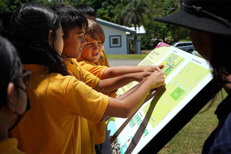
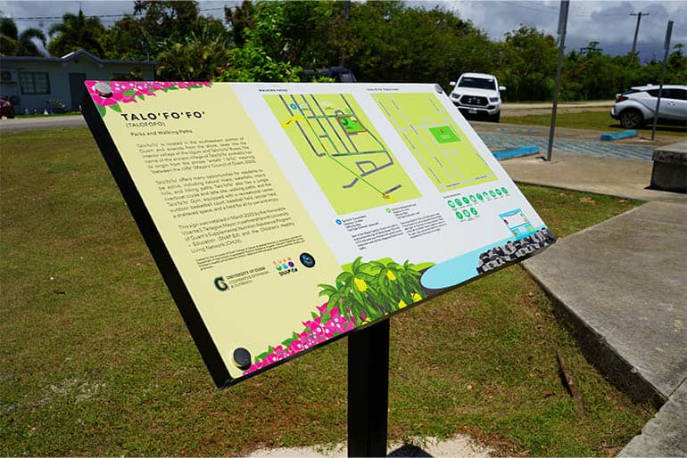
Residents who have been to the Talo’fo’fo’ Baseball Field or the Mangilao Night Market lately may have noticed a colorful new sign featuring walking routes and park maps. The two villages were the first to have the new signs unveiled, with more signs still to come for several other villages.
The maps were created by the Community Nutrition Education Program (CNEP) and the Children’s Healthy Living (CHL) program of University of Guam Cooperative Extension & Outreach and installed by the village mayors to help residents find safe and convenient areas to be active and improve their health.
“Walking and playing at the park is a free and simple way to move more, manage weight, and reduce the risk for chronic diseases,” said Dr. Tanisha Aflague, a registered dietitian nutritionist and coordinator of CNEP and CHL at UOG. “These maps are a great resource to encourage residents to get outside and be active and social, which are both important factors for our health."
The signs include a map of the village’s public park areas, with icons indicating where specific amenities can be found. A second map color codes suggested walking routes, with a description of the route, its difficulty level, and the total distance.
The Talo’fo’fo’ parks and walking paths sign was unveiled with the help of the mayor’s office and students from Talo’fo’fo’ Elementary School, who can be active health champions for their community.
“It encourages [our village’s] residents to check out the routes and, in doing so, will encourage them to take advantage of the opportunities available to improve their health and wellness,” said Mayor Vicente S. Taitague of Talo’fo’fo’.
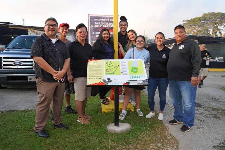
The Mangilao sign, located in between the senior center and Santa Teresita Catholic Church, was unveiled during a recent Mangilao Thursday Night Market.
“We’re very glad to partner with UOG and appreciate the placement of the village walking maps and parks sign here at our community park,” said Mayor Allan Ungacta of Mangilao. “We encourage families and youth of all ages to take advantage of the walking paths and to exercise regularly.”
The next park and walking path signs to be installed will be in the villages of Sinajana and Yoña. Also coming soon from CNEP to specific village parks and daycare playgrounds will be painted game boards featuring fun physical activities to encourage community members and children to be active.
Walking route maps available online
Residents can access walking and park maps for all villages digitally as well at www.uog.edu/extension/cnep on the “Parks and Trails” tab. Video previews of walking routes and parks are also viewable on the UOG CNEP YouTube channel on the “Guam Walk-a-Mile Maps” playlist and the “Parks & Playgrounds” playlist.